Mosquito Fire Update 09/17/22 8:22 PM
Cal Fire
(PLACERVILLE, CALIFORNIA) Sept 17, 2022 —
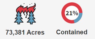
Mosquito Fire Situation Summary:
As anticipated, increased southwest winds arrived today ahead of the approaching storm system with gusts of 20-25 mph along the ridgelines. Increased cloud cover and cooler afternoon temperatures moderated some of the fire activity today. Portions along the eastern flank of the Mosquito Fire remained active this afternoon as the fire continues burning in areas with dry fuels. A spot fire occurred just outside the fire’s main eastern edge in the area of French Meadows Road and crews are actively working to contain it. This spot fire is still within contingency lines that have been constructed on the eastern side of the fire. Firefighters continue to make good progress holding the fire along the Eleven Pines Road and other control lines along the eastern flank moving south towards the Rubicon River drainage. Crews were able to successfully engage in strategic firing operations to continue building a buffer along these control lines. Firefighters have been continuing to patrol the southern and western flanks of the fire to aggressively mop up any remaining hot spots anywhere near control lines. These crews are ensuring that the burned areas along containment lines are completely extinguished with no threat of escape.
Tonight, firefighters will patrol, mop up, and secure all established control and containment lines in an effort to ensure the fire remains within these existing lines while being tested by this wind event. Crews continue to monitor and hold portions of active fire along Deadwood Road and the eastern flank. Night flying helicopters will assist ground crews tonight with reconnaissance and water-dropping missions. Winds are forecasted to diminish overnight, with precipitation starting tomorrow and becoming heavier into Sunday night. The wetting rain is predicted to continue through Wednesday with totals forecasted to be close to 1” by the storm’s end. Firefighters are looking at this wet weather as a speed bump for the fire growth, where they can take advantage of the decreased fire activity and make good progress in increasing containment.
Evacuation Warnings
El Dorado County:
For a map of current evacuation warnings in El Dorado County, please visit:
https://eldoradocounty.maps.arcgis.com/apps/webappviewer/index.html?id=bfbfd933f4254a0db4bdbb2ebe866c10&fbclid=IwAR3J_vO2T2MoA2zjHn365vLIISMCF5egSMFVcitiW4mFe1NWN75v65Dt32I
El Dorado County Fire Information:
https://edcgov.us/mosquito-fire-information
Road Closures
View road closures in the vicinity of the Mosquito Fire on the Caltrans interactive map:
https://quickmap.dot.ca.gov/
U.S. Forest Closures
The Rubicon Jeep Trail Closure went into effect on Friday, September 16 and is covered by two orders: Tahoe National Forest Order No. 17-22-10 which includes lands, roads and trails in the Mosquito Fire Area. View this order and related maps here: https://tinyurl.com/3uapupe5 and Lake Tahoe Basin Management Unit Order No. 19-22-07 https://tinyurl.com/2p9ckfcr
El Dorado National Forest: The forest has issued a Forest Closure Order No. 03-22-16 which includes lands, roads and trails in the Mosquito Fire Area. View this order and related maps here: https://tinyurl.com/5dxz5cp6
Tahoe National Forest: The Tahoe National Forest has issued Forest Closure Order No. 17-22-09 which includes lands, roads and trails in the Mosquito Fire Area. View this order and related maps here:https://tinyurl.com/2dfxw6v9