MOSQUITO FIRE INCIDENT UPDATE Date: September 8, 2022 Time: 10:00 P.M.
The current verified acreage of the fire is at least 23,000 acres.
CAL FIRE NEU
(PLACERVILLE, CALIFORNIA) Sept 8, 2022 — INCIDENT FACTS
Incident Start Date: September 6, 2022
Incident Start Time: 6:22 P.M.
Incident Type: Wildfire
Cause: Under Investigation
Incident Location: Mosquito Rd at Oxbow Reservoir
CAL FIRE Unit: Nevada-Yuba-Placer
Unified Command Agencies: CAL FIRE NEU, USFS Tahoe National Forest, Foresthill Fire Protection District, and Placer County Sheriff’s Office
Size: 13,704 Acres
Containment: 0%
Expected Full Containment: October 15, 2022
Civilian Injuries: 0
Firefighter Injuries: 0
Structures Threatened: 3,666
Structures Destroyed: 0
Structures Damaged: 0
CURRENT SITUATION
Today’s operational period saw the continued extreme growth of the Mosquito Fire, as it has now burned 13,704 acres and progressed into El Dorado County. Fire activity has included crown runs and spotting which is expected to occur throughout tonight. The winds and steep terrain have been in alignment which have combined to create the conditions conducive to the observed fire conditions.
This caused new evacuation orders to be issued by the El Dorado County Sheriff’s Office for the communities of Volcanoville, Georgetown, and Bottle Hill while Cool is under and evacuation warning. Additionally the Placer County Sheriff’s Office expanded its evacuation orders into Todd Valley. As the incident continues to evolve, reconciliation of resources and
The priority for firefighting personnel is the life safety of the community and structure protection. Additionally, the construction of direct and indirect containment lines utilizing handcrews and bulldozers is a significant objective. As the incident evolves, reconciliation of resources and the number of community members affected will continue to be updated
The Unified Commanders of the Mosquito Fire thank the community for their support and cooperation in adhering to evacuation orders and warnings, and remind those who are in an area when an evacuation order is implemented that it is time to leave. The decision to evacuate a community is done with the understanding of the inconvenience it places on those who live and work in a community, but also with the priority of life safety. Be Ready, Set, Go! and visit www.readvforwildfire.org.
Evacuation Orders Placer County
For a map of current evacuation orders in Placer County, please visit: https://bit.ly/3BtKFk4
EVACUATION ORDERS are in effect for the following communities:
Zone 1-
Michigan Bluff
• Michigan Bluff Rd
• Gorman Ranch Rd
• Chicken Hawk Rd
• Ridge View Rd
• Deadwood Rd
Zone 2 —
Baker Ranch
• Mobile Home Park
Zone 3 —
Crystal View Rd and Bath Rd
Zone 4—
Foresthill
• Foresthill Rd from Idlewild Rd to Bath Rd
• Powerline Rd
• Timberland Rd
• Sluce Box Ln
Zone 5
• Black Oak Ridge Rd
• Blackhawk Ln
• Ebbert Ranch Rd
• Old Ebberts Ranch Rd
Zone 6
• Finning Mill Rd to Sugar Pine Rd to Elliot Ranch Rd to Forestill Rd
• Big Reservoir Rd
• Giant Gap Rd • Hollow Log Rd
• Prospect Rd, NF-10
Evacuation Warnings Placer County For a map of current evacuation orders and warnings in Placer County, please visit: https://bit.ly/3BtKFk4
An EVACUATION WARNING is in effect for the following communities:
Zone 7 — Todd Valley
• South of Foresthill Road North of the middle fork of the American River
• West of Jarvis to include Patent
• East of McKeon Ponderosa to the American River
Zone 8 — Sky View 121200 Todd Valley Road)
• Sky View Mobile Home Park
Zone 9 — North Side of Foresthill Road
• North of Foresthill Road
• South of Yankee Jirns Road through Spring Garden to include Owl Creek and Pine Mountain
• Everything west of Power Line and Hard Rock
Zone 10 — Spring Garden / Whitehawk Ridge
• North of Spring Garden Rd. and east of Ponderosa Rd. to the North Fork of the American River
• South of the North Fork of the American River.
• South of Yankee urns Road to Spring Garden
Zone 11— Yankee Jims and Shirttail Canyon
• North of Yankee urns Road to include Shirttail Canyon
• South of Big Dipper through Kings Hill and through Black Bear and Grills Hill
• West of Finning Mill Road
Evacuation Orders El Dorado County
For a map of current evacuation orders and warnings in El Dorado County, please visit: https://bit.lv/3ATtqao
EVACUATON ORDERS are in effect for the following communities:
• Volcanoville: Residents who live north of Wentworth Springs, east of Otter Creek, South of the Placer County Line, and west of Tunnel Hill Road are under mandatory evacuation orders. Please evacuate the area immediately.
Stumpy Meadows
• East of Stumpy Meadows
• West of Loon Lake
• South of the County border
• North of Little Silver Creek Slate Mountain, including Swansboro
• East of Garden Valley
• South of Sand Mountain
• North of the Mosquito Bridge
• West of Traverse Creek
Cool
• East of Highway 49
• South of the County Line
• North of Highway 49/Coloma Road
• West of Greenwood Road
Evacuation Centers
Placer County
Bell Road Baptist Church: 77 Bell Road,
Auburn, CA 95603
El Dorado County
Cameron Park Services District, 2502 Country Club Drive, Cameron Park, CA 95682
Overnight shelter, meals, showers, limited health services, and parking for trailers will be provided.
Animals in crates and carriers will be accepted.
Road Closures Placer and El Dorado County: https://quickmap.dot.ca.gov/
Animal Evacuation Centers
Placer County Placer County Animal Services Center: 11232 B Avenue,
Auburn, CA 95603 Nevada County Fairgrounds: 11228 McCourtney Road,
Grass Valley, CA 95949
The #MosquitoFire Large Animal Shelter at Saureel Vineyards is closed.
Evacuees with large animals can call Rancho Murieta Equestrian Center at 916-826-4278 to coordinate shelter.
— El Dorado County Sheriff’s Office
ASSIGNED RESOURCES Engines:
TBD Water Tenders:
TBD Hand Crews:
TBD Dozers:
TBD Total Personnel:
1,700 Aircraft: Aircraft remains available as requested by fire personnel to assist with fire suppression operations.
Cooperating Agencies: Foresthill Fire Protection District, CAL FIRE AEU, El Dorado County Sheriff’s Office, USFS El Dorado National Forest, California Highway Patrol, California Governor’s Office of Emergency Services, California State Parks
To learn more about wildfire preparedness visit: www.readyforwildfire.org
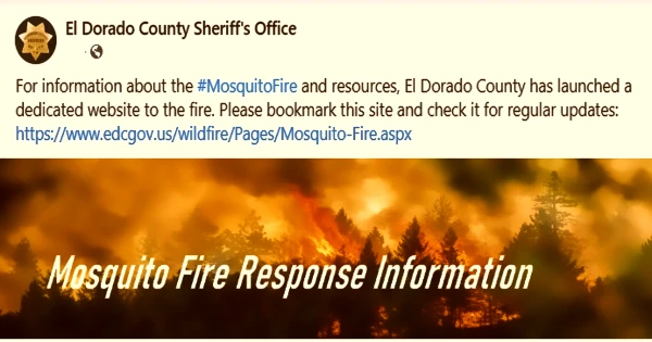
For information about the #MosquitoFire and resources, El Dorado County has launched a dedicated website to the fire.
Please bookmark this site and check it for regular updates: https://www.edcgov.us/wildfire/Pages/Mosquito-Fire.aspx
it seem as though the eldorado side of the middle fork of the American river hasn’t moved very much, is that so?