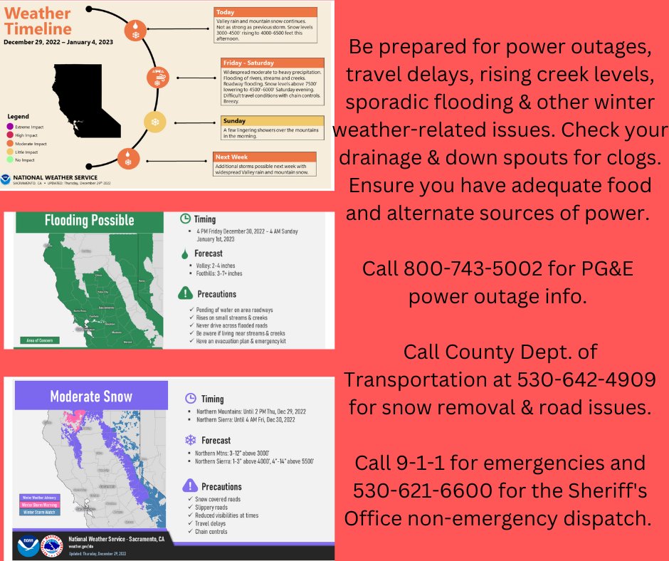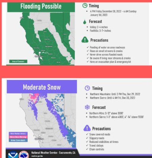
The National Weather Service predicts rain up to 5 inches
The National Weather Service predicts rain up to 5 inches and snow up to 2 ft depending on elevation starting today through Sunday.
An active weather pattern will continue into the weekend for much of the western U.S. as a series of upper level disturbances move into the region.
While snow levels are still relatively low as of Thursday afternoon from the Sierra Nevada into the Cascades of Oregon, warmer Pacific air will flow into the region near and just south of a cold front that will reach the West Coast tonight, raising snow levels for locations from southern Oregon into central and northern California. The cold front is not forecast to make much southward progress through Friday which will focus a slow moving axis of moderate to heavy precipitation into northern California, with snow reserved for only the highest elevations of the mountains from southern Oregon into northern California. The cold front is expected to begin shifting south on Saturday, translating the threat of heavy rain and flooding southward into southern California beginning Saturday afternoon.
Through late Saturday, 1-3 inches of rain is forecast for the Sacramento Valley while 4 to 8 inches of rain, locally higher, can be expected to impact the foothills and favored upwind portions of the Coastal Ranges into the central and northern Sierra Nevada. Given warmer temperatures and heavy rain for these locations, areas of flooding are expected for portions of the West Coast with a focus from southwestern Oregon into central and northern California through at least Saturday, with snow melt a contributing factor.