Storm warning: Multiple feet of snow expected through weekend
Bill Rozak
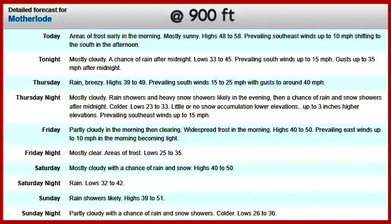
LAKE TAHOE, Calif. — Multiple feet of snow is expected for Lake Tahoe through the weekend from two separate storms with the first entering the region Wednesday night.
The National Weather Service in Reno issued a winter storm warning Tuesday afternoon for up to 2 feet of snow above 7,000 feet and 10 to 20 inches at lake level. The warning is in effect from 10 p.m. Wednesday to 10 a.m. Friday.
Strong winds will reach up to 45 mph with gusts near or above 100 mph over Sierra ridgetops.
Travel during the warning will be difficult with hazardous conditions impacting the morning and evening commutes. Strong winds could cause damage to trees and lead to power outages.
The heaviest snowfall rates are anticipated Thursday and could reach 3 inches per hour. The combination of heavy snow and strong winds may lead to whiteout conditions and hazardous driving conditions.
Officials urge motorists to stay off the roads.
“If you must travel, prepare for long delays and carry an emergency kit with extra food, water and clothing,” the warning said. “If you stay home, have a backup plan in case of power outages.”
For road conditions, check with Caltrans at quickmap.dot.ca.gov and NDOT at nvroads.com.
The Sierra Avalanche Center has also issued an avalanche watch through Friday morning for the region.
The center said, “A winter storm and gale winds loading substantial amounts of new snow onto a weak existing snowpack may result in widespread avalanche activity in the mountains. Large avalanches could occur in a variety of areas.”
The weather service said on Wednesday morning that the next storm expected to hit the region on Saturday may not be as strong as Thursday’s, however the slower moving system may provide another 1 to 2 feet.
Officials said this snow will last from Saturday morning through Sunday night, with the most persistent snowfall likely being Saturday night into Sunday morning.
Winds will start to pick up Saturday morning ahead of the system and peak Saturday evening, with gusts along the Sierra crest 80-plus mph.
The high temperatures through the weekend will be in the upper 30s and will struggle to reach 40.
After the storms pass, the service said next week will begin with dry conditions and below average temps.
Detailed forecast for 904 ft
Content retrieved from: https://www.sierrasun.com/news/storm-warning-multiple-feet-of-snow-expected-through-weekend/.